Seerah Map Complete Set
Original price was: ₨5,600.₨3,500Current price is: ₨3,500.
Seerah Maps: A Visual Journey Through Islamic History
To truly understand the Seerat-un-Nabi ﷺ, one must understand the land where history was made. Our Seerah Maps collection offers a profound geographical perspective on the most pivotal moments of the Sirah. From the mountains of Makkah to the trenches of Madinah, these maps are an essential resource for every Muslim household, school, and library.
Explore the Complete Collection (8 Unique Designs)
Each map in this series is designed to simplify complex historical events mentioned in the Seerah:
-
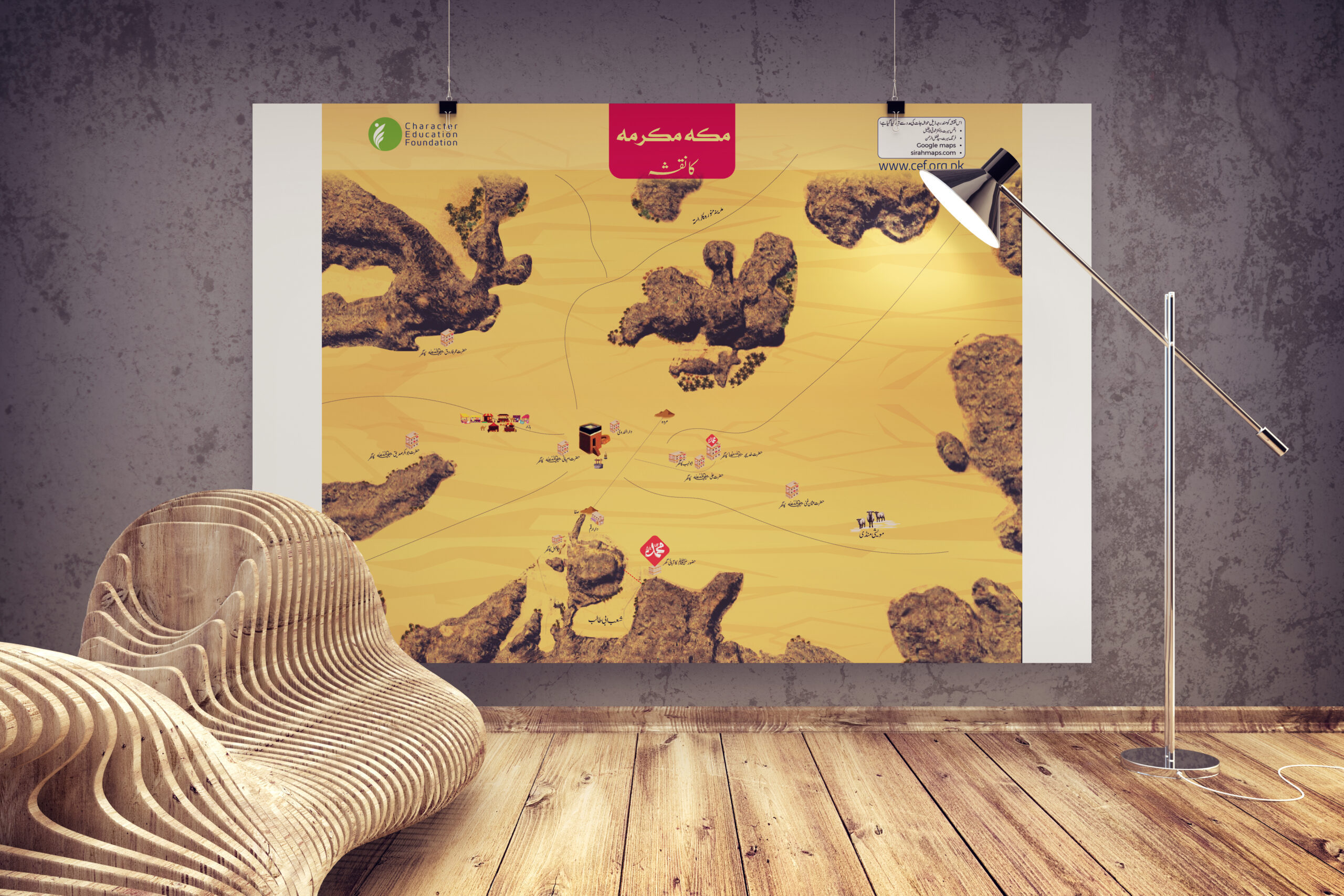
Makkah Valley Map: A detailed topographical view of the sacred city where the Seerat began.
-
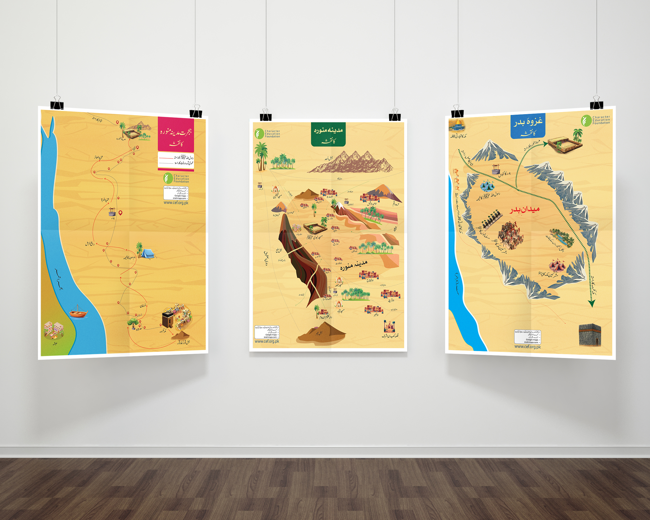
Madinah Map: A geographical representation of the City of Light during the Prophet’s (ﷺ) era.
-
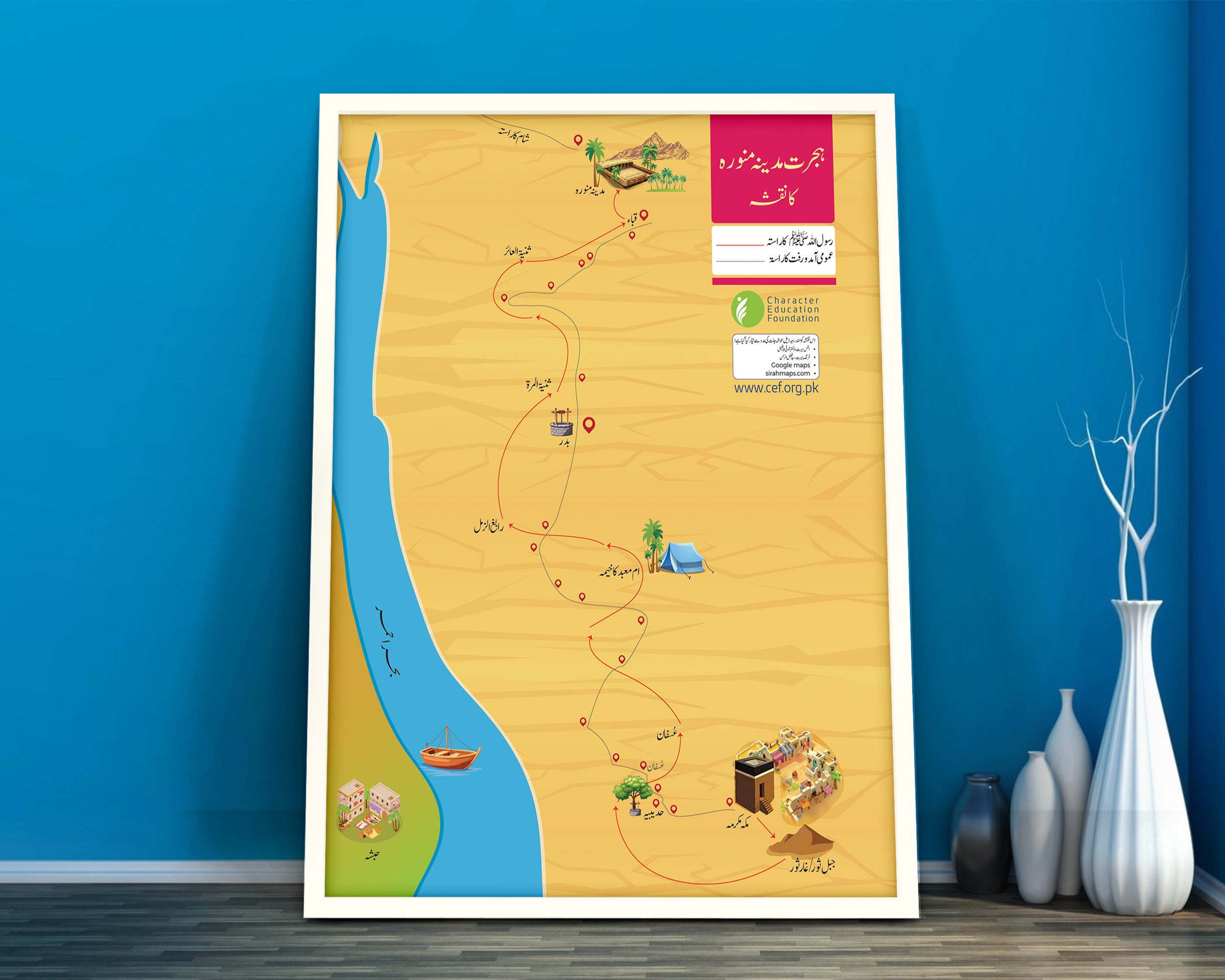
Hijrah Route Map: A step-by-step visualization of the miraculous migration—a turning point in the Sirah.
-
Battle of Badr Map: Study the strategic troop positions and landmarks of Islam’s first major victory.
-
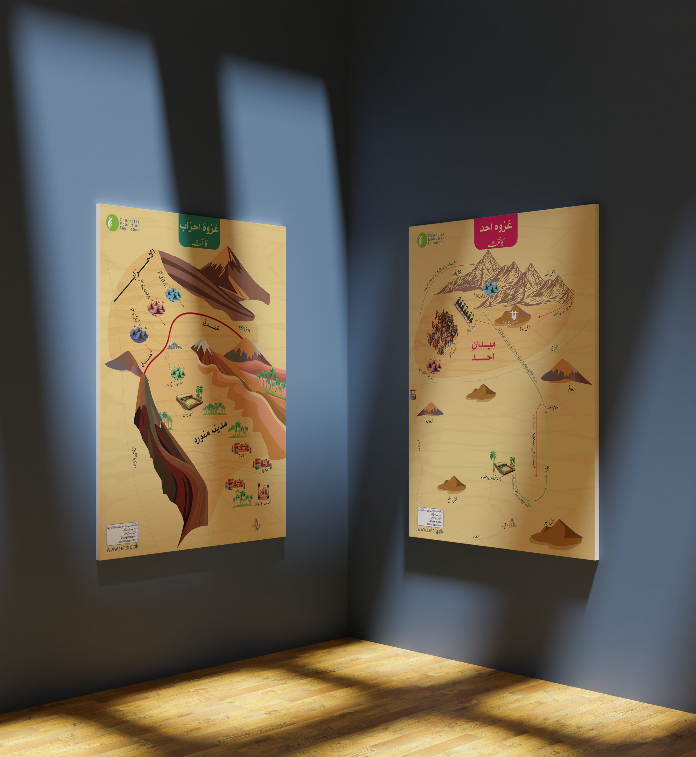
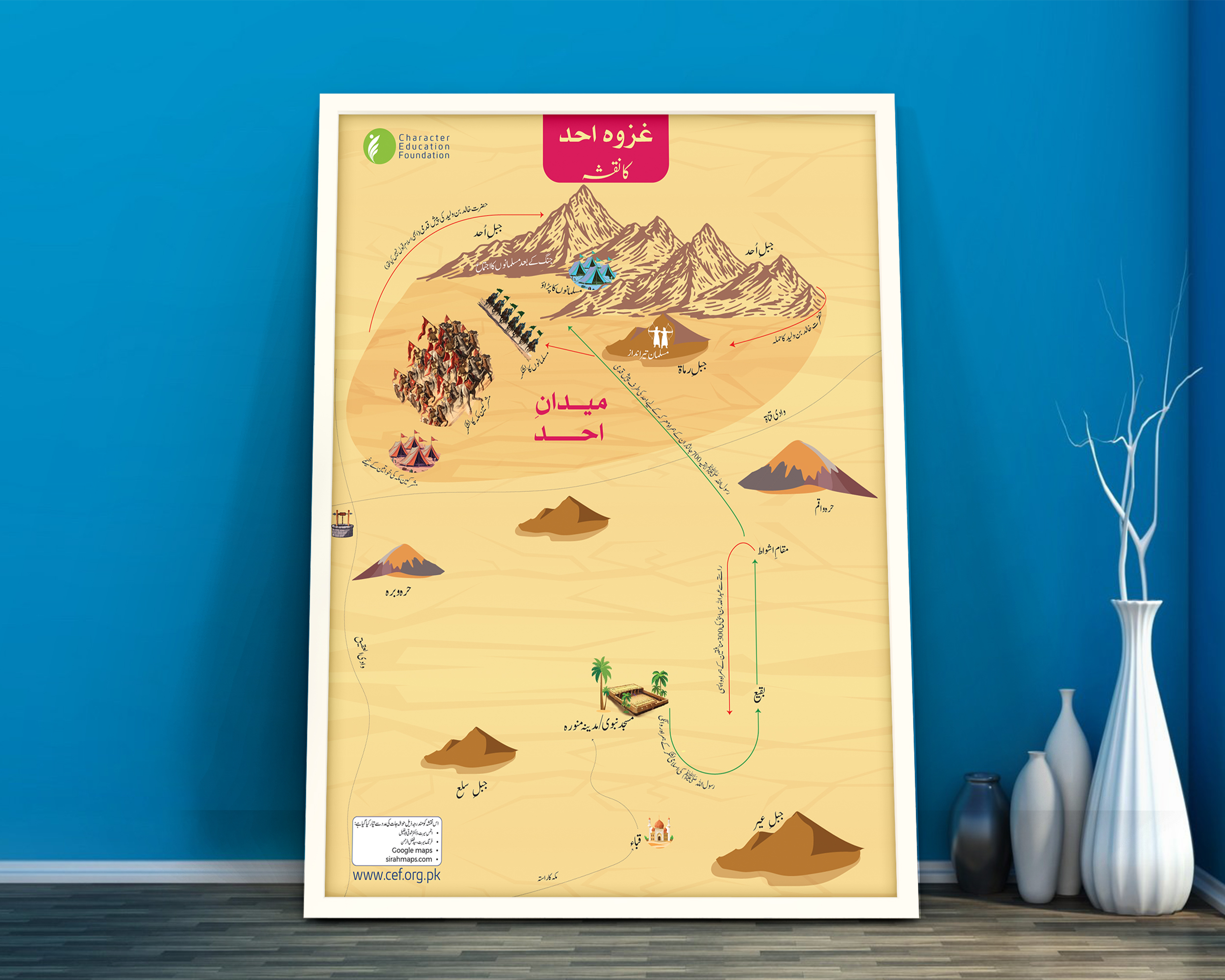
Battle of Uhud Map: Illustrates the terrain and key movements that defined this significant event.
-
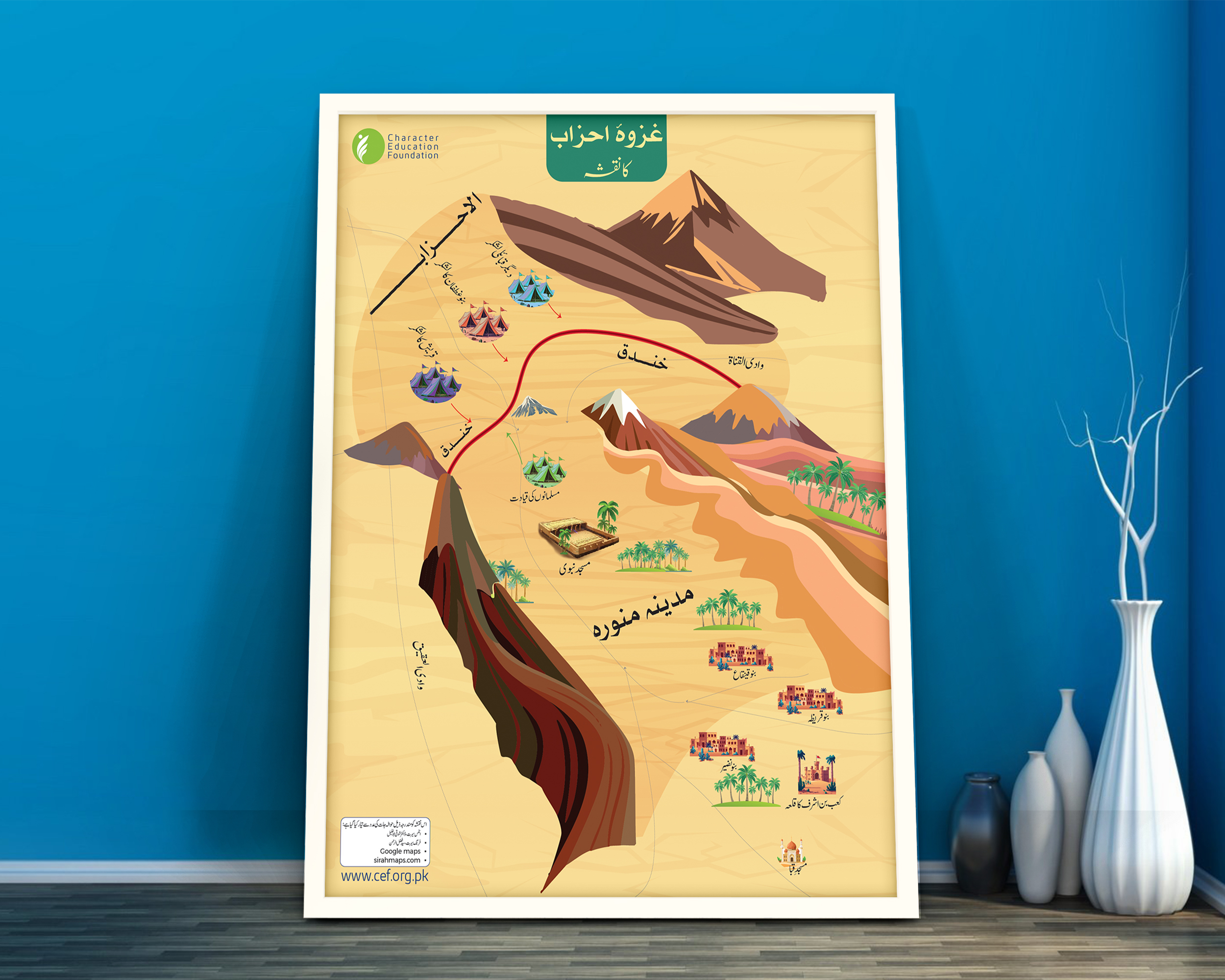
Battle of Ahzab (Trench) Map: See the defensive layout and the historic trench strategy used to protect Madinah.
-
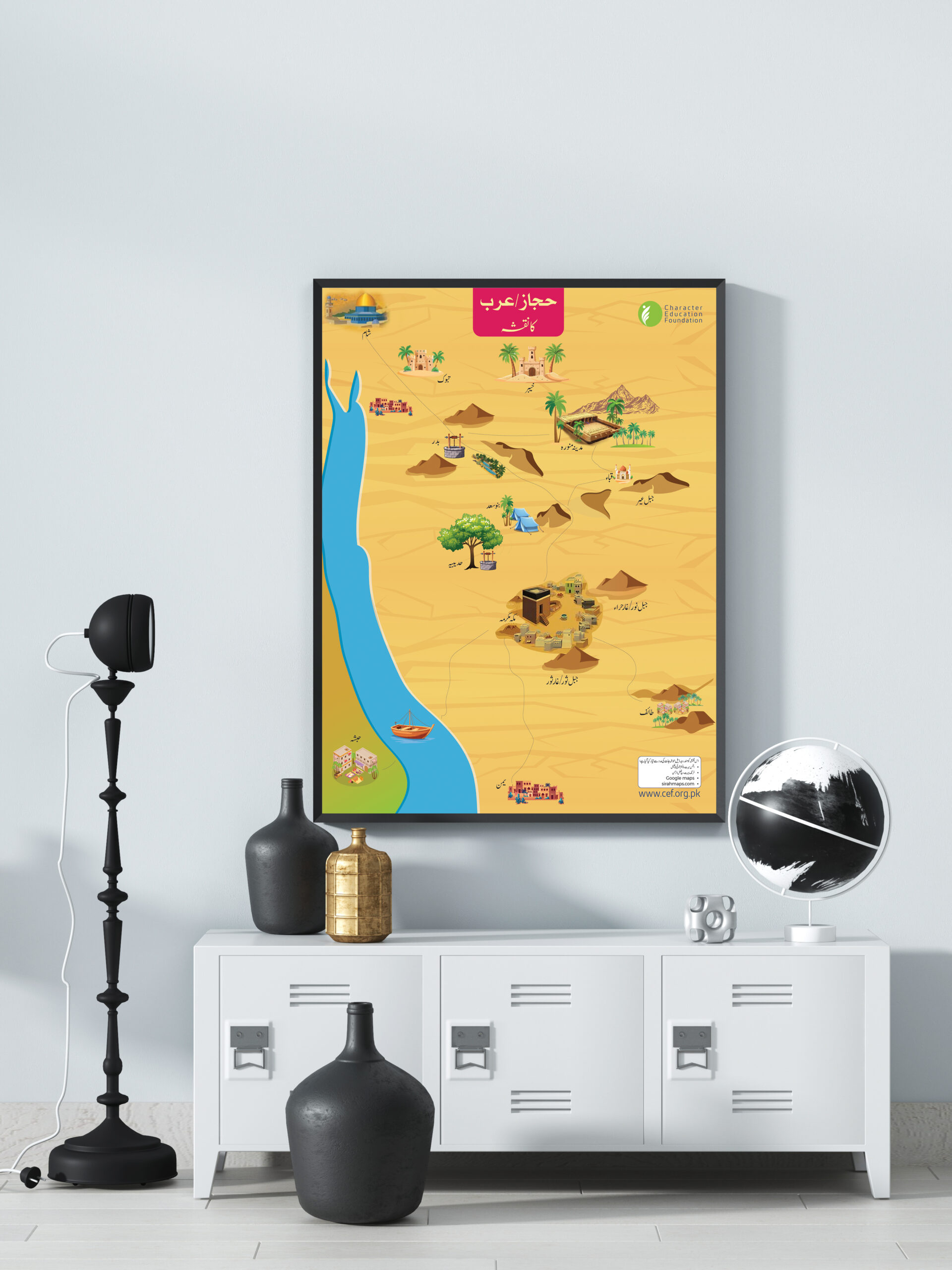
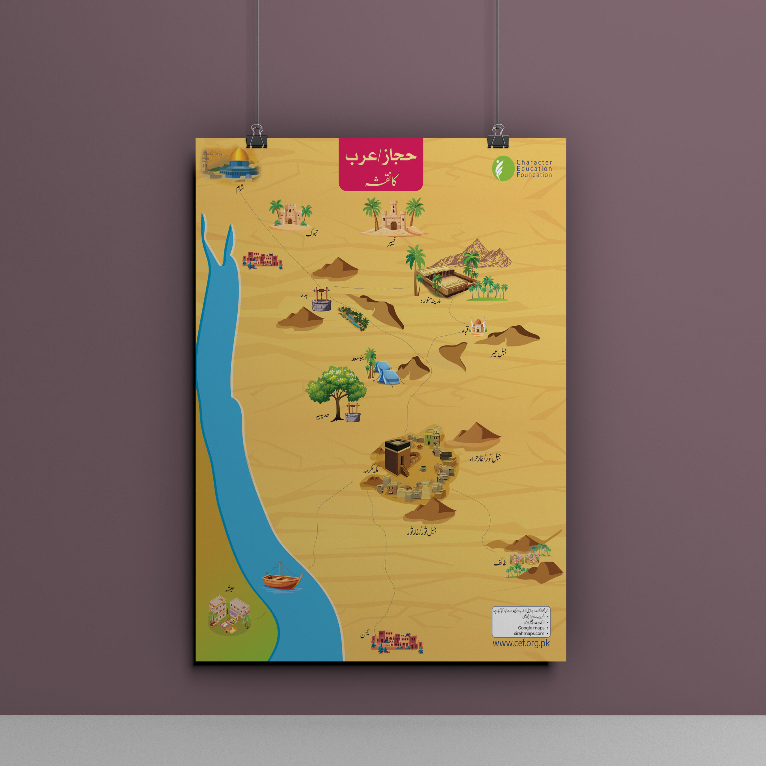
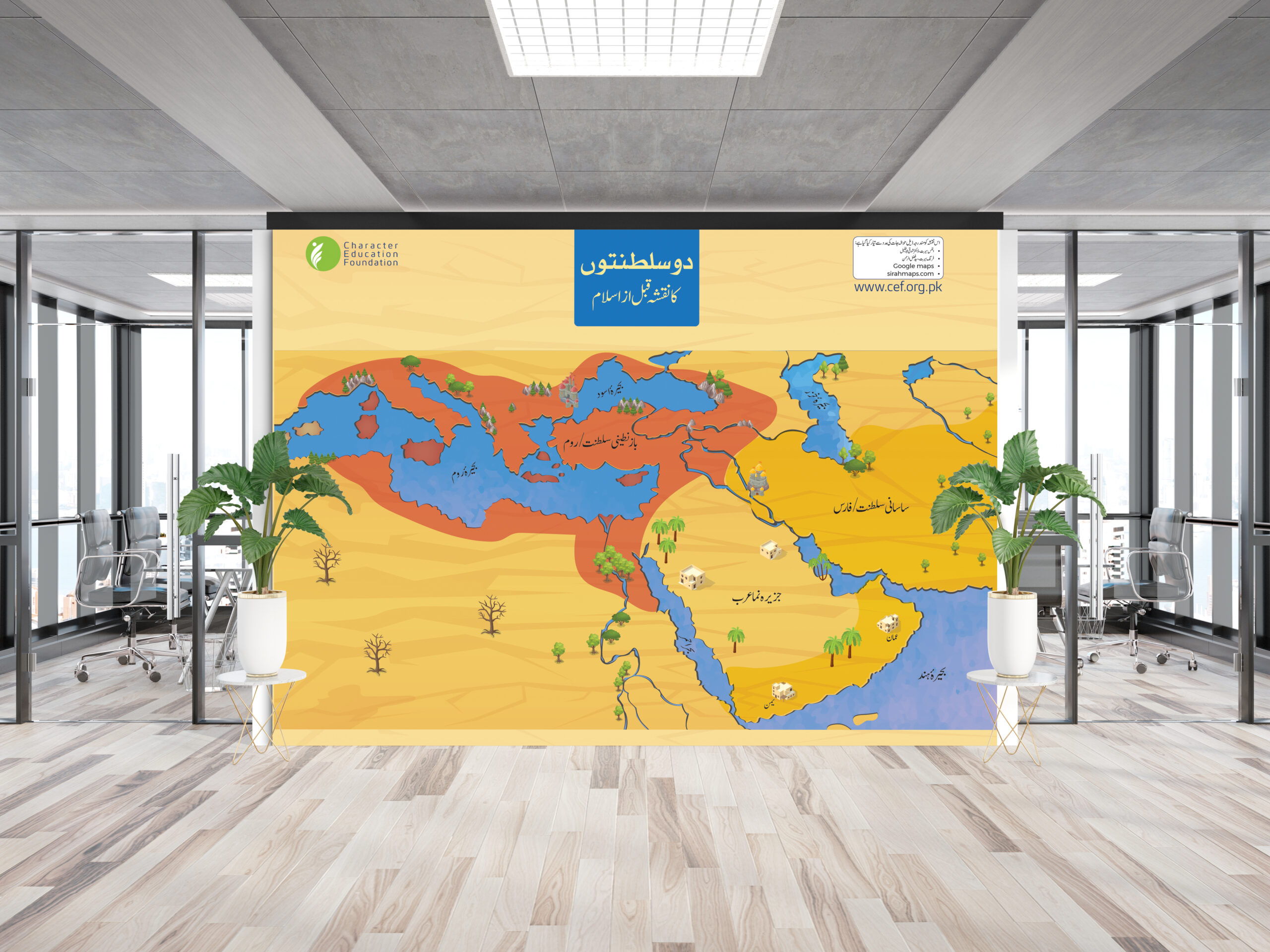
Hijaz Region Map: Covers the broad historical and geographical landscape of the Hijaz.
-
Islamic World Map: Displays the expansion of Islam and key locations during the Prophet’s (ﷺ) mission.
Why These Maps are Essential for Learning:
-
Large-Scale Detail: Every map comes in a generous 20 inches x 30 inches size, making them ideal for wall mounting and group study sessions.
-
Chronological Learning: Use them alongside your favorite Seerat books to track the Prophet’s ﷺ journeys and battles accurately.
-
High-Quality Printing: Sharp text and vibrant colors ensure that every route and location in the Sirah is easy to identify.
-
Interactive Education: Perfect for homeschooling and Islamic schools to engage children in the Sirah of Prophet Muhammad ﷺ through visual aids.
Specifications:
-
Map Size: 20″ x 30″ (Per Map).
-
Language: Clear and easy-to-read English/Arabic terminology.
-
Usage: Ideal for framing, wall-hanging, or classroom teaching.
Bring the stories of the Seerat into your home with clarity and precision. Order your Seerah Maps today!
Seerah Maps – Visualizing Key Events of Islamic History
- Makkah Valley Map – Detailed topographical view of Makkah and its surroundings.
- Madinah Map – Geographical representation of Madinah during the Prophet’s (ﷺ) time.
- Hijrah Route Map – Step-by-step visualization of the migration from Makkah to Madinah.
- Battle of Badr Map – Strategic troop positions and key locations of the first major battle in Islam.
- Battle of Uhud Map – Illustrates troop placements and significant events of the battle.
- Battle of Ahzab (Trench) Map – Shows the defensive strategy and layout of the historic battle.
- Hijaz Region Map – Covers the historical and geographical significance of the region.
- Islamic World Map – Displays the key locations and expansion during the Prophet’s (ﷺ) time.
- Map Size -- Every Map Size : 20 inches x 30 Inches.
Additional information
| Weight | 0.9 kg |
|---|

zohaib Shehzad –
excellent for schools.